Soil and Water Conservation in Lake Manyara National Park
Lake Manyara watershed is one of the two catchment basins that sustain the Tarangire-Manyara Ecosystem in Northern Tanzania. It drains water from several perennial and seasonal rivers from complex of highlands in Karatu, Ngorongoro, Mbulu and Nou forest. The watershed is important for conservation, as it influences local land use practices and attracts wildlife. Lake Manyara provides critical habitat for aquatic fauna and birdlife, also habitat for resident and migratory wildlife.
The lake faces serious threats from land use changes, poor farming practices, tourism impacts, population increase, etc. These result in decline in the water volume flowing into the lake, heavy siltation and pollution in the lake and reduction in water quality due to potential pollution from pesticides and fertilizers. In recent years Lake Manyara has been faced with a series of drying-up events that threatened the life and survival of aquatic creatures there. In 1993, 1996, 2000, 2003 and 2004 there were massive deaths of flamingos (lesser flamingo) due to them consuming toxic algae in the lake that was caused by a change in the lake’s water chemical composition due to low water levels.
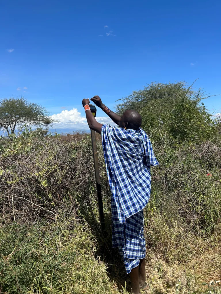
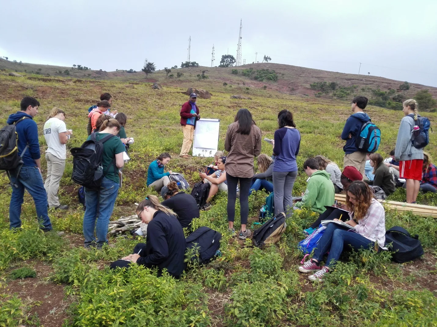
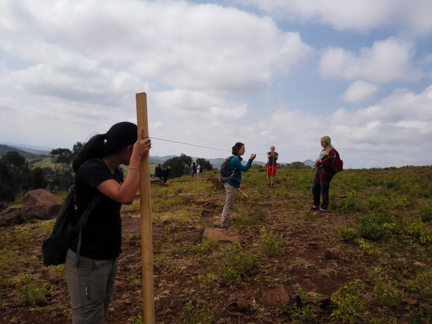
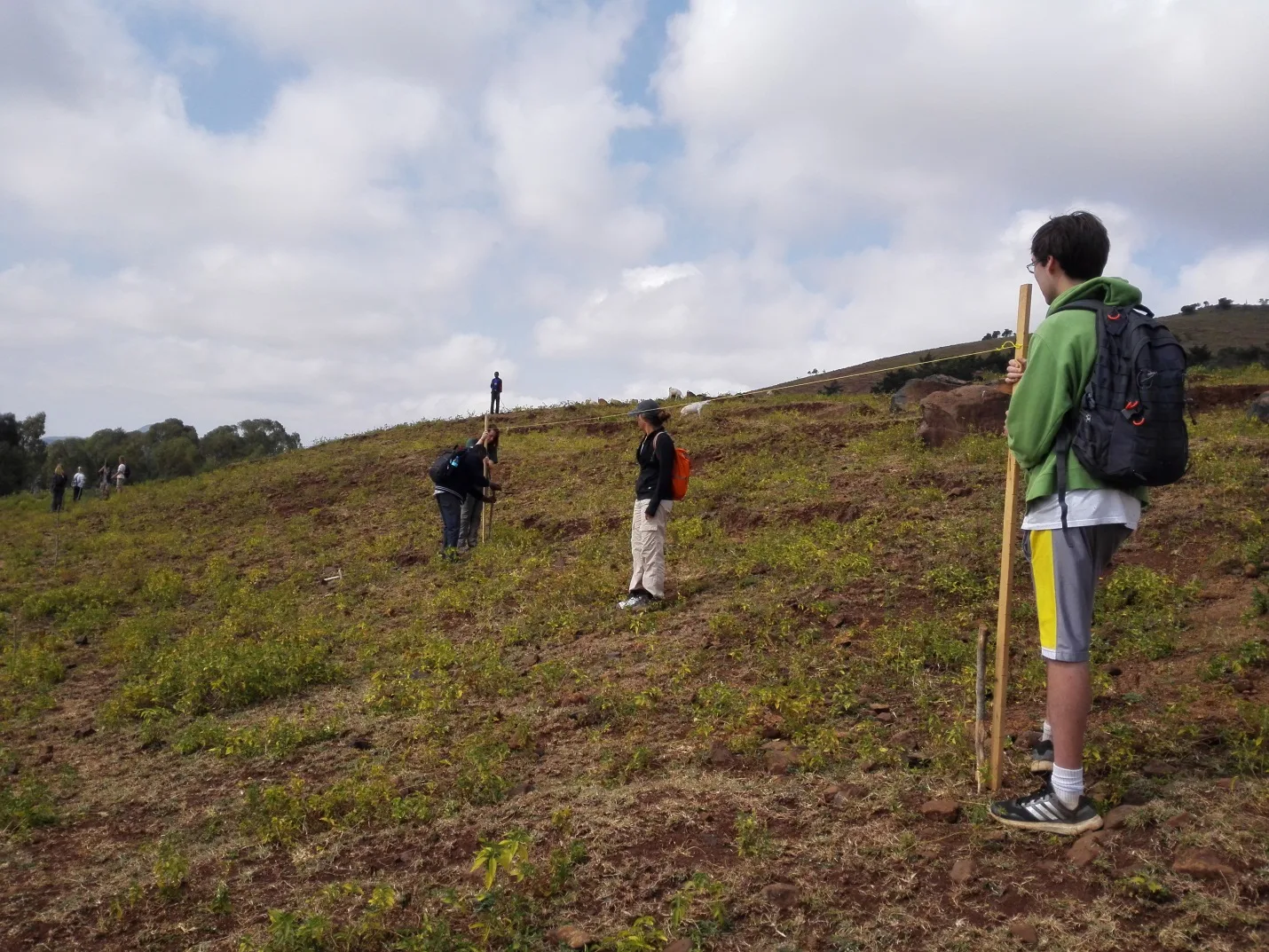
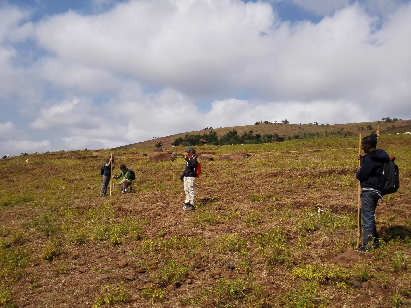
To reduce siltation of the lake, soil conservation measures in catchment areas of Lake Manyara should be practiced through the use of low-cost, simple techniques suitable for the local environment. Such techniques will achieve high rates of implementation and sustainability. The Center for Wildlife Management Studies (CWMS) Moyo Hill, Tanzania had an opportunity to learn one of the techniques used in water and soil conservation in a hilly terrain of a Karatu area. This technique consisted of laying out contours / terraces using Line Level method. This method is preferable in rural areas because it is simple to learn and the equipment is affordable. The line level technique for laying out contours uses the following resources; a pair of line level boards of 150 centimeters (graduated), a spirit level, manila string of 10 meters in length, wooden pegs and hummer and a team of 4 people. The team comprises of 2 line level board holders, one person for reading spirit level at the center, and a pegger.
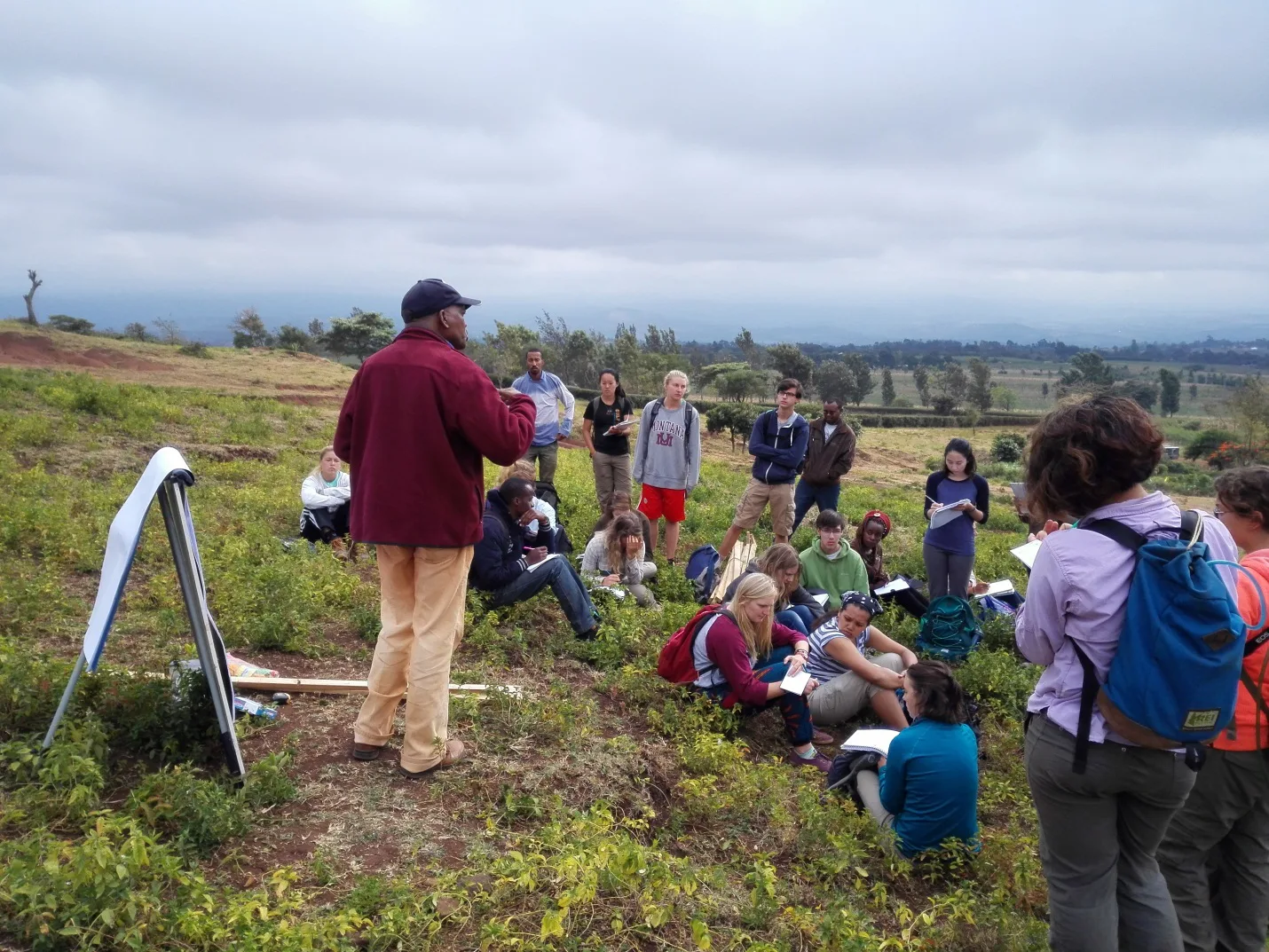
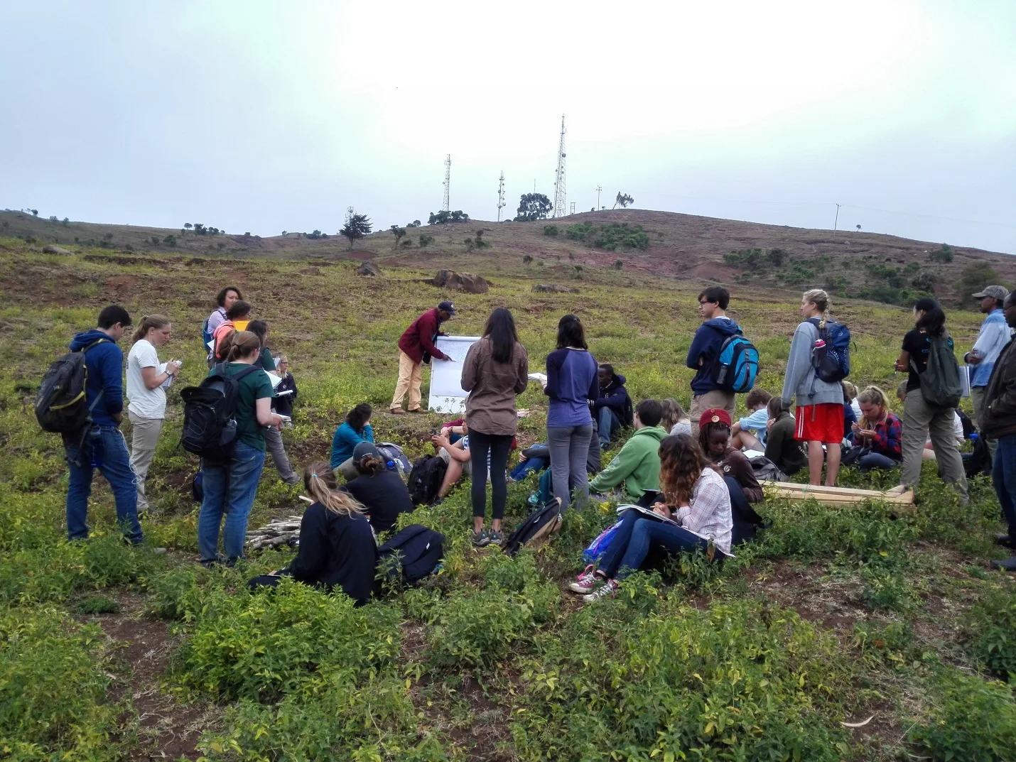
For the purpose of learning this technique, students went to Gyekum-Arusha village which is located about 5 kilometers south of Karatu town. At the site students were given a theoretical overview of the erosion problem in Karatu highlands that causes siltation in lake Manyara and various methods used to reduce erosion, specifically contour making through use of line-level techniques. Thereafter, students practiced laying out contour / terraces lines.
Usually after establishing contour lines, the farmer builds contour ridges with a plough or a hand-held hoe. Later, the contour ridge can be stabilized by planting grasses (elephant grass is commonly used in the area) and trees. The contours and vegetative materials that are planted help reduce the speed of surface-flowing rain water.
At the end of the field practice there was a discussion about the field experience. The students agreed that the method was easy to learn and apply. The students also realized that the space between terraces depends on: Rainfall intensity, slope steepness and its length, soil erodibility characteristics and expected future use of the land.
Related Posts
Alumni Reflections: Stories of the Return to Kenya